Enhanced Agricultural Productivity, Food Security, and Natural Resources Management
The Permanent Interstate Committee for Drought Control in the Sahel (CILSS) conducts research and distributes information on climate and weather patterns, water management, market systems and agricultural statistics, and implements early-warning systems for ecological events that affect farmers. Through these endeavors, CILSS aims to help vulnerable populations of the Sahel and West Africa (WA) to better predict, adapt to and recover from their changing environment. It coordinates AGIR (the EU’s Global Alliance for Resilience Initiative) in partnership with the Economic Community of West African States (ECOWAS) and the West African Economic and Monetary Union (French acronym: UEMOA).
Activity Description
USAID’s support to CILSS has increased its capacity enormously, transforming CILSS into the leading technical arm of principal regional institutions, ECOWAS and UEMOA. This support has helped CILSS to:
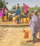
- Create a “cadre harmonisé”— a regional standard of assessment for food security, nutrition and vulnerability. These common assessment tools and standards enable country stakeholders to jointly decide on emergency status and accurately analyze regional vulnerability to better target their aid efforts.
- Collect and disseminate agricultural, meteorological and trade data relating to food security so all farmers in the region have access to the same information and technology to mitigate climate risks and increase their profit margins from staple and cash crops.
- Promote resilience by helping farmers mitigate, respond to and recover from natural shocks through USAID-supported CILSS early warning systems for weather patterns and ecological crises.
- Standardize sanitary and phytosanitary policy throughout the region so farmers and consumers have the same protection from biosafety risks.
- Monitor changing land use patterns and the impact of land degradation, desertification and human use on the environment through the CILSS/U.S. Geological Survey West Africa Land Use and Land Cover Trends Project. By documenting the changing landscape using satellite images and local knowledge, CILSS provides decision makers with information needed for managing their natural resources.
- Assist countries to initiate and train a national team for biosecurity analysis.
- Dispense tools and strategies for the integration of nutrition into public policy in six of the 13 member states.
Actual Outcomes
The Project has:
- Created a cadre harmonisé that determines five stages of vulnerability. It uses 12 different indicators for the analysis: availability of food, accessibility of food, malnutrition, water supply, etc.
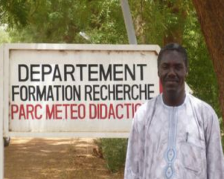
- Created GRHYMET, a regional system for collecting and disseminating information on agriculture, hydrology and meteorology, and for training staff from member states on these areas.
- Regularly disseminates information to farmers by radio, using weather and climate information systems to advise farmers on how to best time their planting and whether or not to use short-season varieties of seeds in order to maximize production.
- Improved early warning systems for farmers so they can better prepare for, deal with, and recover from ecological crises like drought or flood.
- Initiated of a data collection system for regional trade.
 Biosphere through support to community-based environmental monitors. Photo credit: Resilient Waters")